
View James Moody's photo gallery
You can order the DVD from the Academy for $15 (including GST and postage)
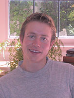
James Moody was interviewed in 2002 for the Interviews with Australian scientists series. By viewing the interviews in this series, or reading the transcripts and extracts, your students can begin to appreciate Australia's contribution to the growth of scientific knowledge.
The following summary of Moody's career sets the context for the extract chosen for these teachers notes. The extract illustrates Moody's interest in space and the environment. Use the focus questions that accompany the extract to promote discussion among your students.
James Moody was born in Queensland in 1976. He graduated from Queensland University of Technology in 1998, with degrees in electrical engineering and information technology, winning the University Medal in both. He is a PhD student at the Australian National University with the Centre for the Mind and the Australian Asia Management Centre. His PhD research is on strategic management theory and the management of complex projects within the space industry. As part of this research, Moody has been the systems manager for the Cooperative Research Centre for Satellite Systems to build and launch FedSat, Australia's first satellite in 30 years.
In 2000 Moody was the Young Queenslander of the Year, as well as the Young Professional Engineer of the Year. In 2001, he was the Young Australian of the Year in the Science and Technology section. Moody is co-chair of the Youth Advisory Council to the United Nations Environment Programme and was a member of the Science and Technology delegation to the UN World Summit on Sustainable Development in Johannesburg in 2002.
You are currently finishing off your PhD on Australia's new satellite, FedSat. Why is FedSat so important?
FedSat, the Federation Satellite, is Australia's first satellite in 30 years. (Australia was the fourth country in the world to launch a satellite from our own turf, 32 years ago. So we were in there with the space industry from the very beginning, although we haven't been doing much since then.) I was lucky enough to be one of the small team of people who were building the satellite itself. My job was the systems manager, responsible for all the different pieces being put together.
Although this is a $40 million satellite, it's actually quite small – about 50 cm by 50 cm. We like to say it's the size of a bar fridge. If it were a computer, it would be more a PC than a mainframe. Yet it is incredibly complex, with communications systems, power systems, attitude control (pointing systems) to be interfaced and plugged in. And if something doesn't fit into something else, my job is to find a way around that. We have to fix it.
What will FedSat do?
This is a research satellite, so we are trying to get Australian technologies and put them in space to test them. For example, we have got a high-bandwidth communications payload looking at getting direct high-speed Internet to the bush. We have got a magnetometer and a GPS receiver to measure our ionospherics, looking at space weather. And we have got a 'reconfigurable' computer – that is, it can change its hardware in space, halfway through a mission.
You also manage several companies. What is the focus of the work that you are currently involved with?
I have got one media company, but most of my companies are involved in my two passions, space and the environment. One is a space engineering company, for example, and another is a sustainable development and environmental consulting firm. My latest endeavour (which is taking up a lot of my time) combines my passions in one company, Mitchell Resource Intelligence. We are taking space data – images of the Earth from space – and applying it to the environment. We can now look from space at crops, at vegetation, at climate, at water use. We can increase a farm's water efficiency by 25 per cent, for example, by means of this data. And from the air we can measure soil quality. Using the data we can start to make better choices about how agriculture can work in Australia and also about how we can benefit the environment.
As one example, in Cootamundra, New South Wales, part of the Olympic Highway kept falling apart every year. Everybody was blaming each other: vibrations from the nearby train line were blamed, or it was thought that somebody was washing water across the road and so destroying it. But our company could see through the road to measure the salt in the ground and we found there was actually a salinity pathway right underneath, where nobody had been able to detect it before.
How do you see through a road?
You use radioactive small particles called gamma rays. It turns out that salt in the ground, thanks to cosmic radiation, is a little bit radioactive itself. And that's how we measure it. Using our information, then, meant the road could be covered with a piece of plastic, in effect, and rebuilt. They have never had the problem again.
Australia is going through a major drought. Can your imaging work help us cope better with drought?
Our work with Mitchell Resource Intelligence is all about gaining more information about the country. For example, with thermal satellites or synthetic aperture radar we can find out where there are water irrigation channel leakages – through which we lose a lot of water – so those problems can be addressed immediately. We can find out where people are over‑irrigating, so we can start addressing these problems to increase the water efficiency of farms. There are many other things we can start doing, such as understanding the soils. We can measure soils directly now, so we can listen to what the land is telling us and start putting crops in the right places, based on the soil type and acidity. That is the whole idea: not only are we going to make more money for the agricultural areas because we will have better crops, but we are also going to help the environment and make Australia more sustainable.
Is there a difference between spatial 'information' and spatial 'intelligence'?
According to a well‑known saying, 'Information is not knowledge, knowledge is not wisdom.' Information by itself is actually quite useless. There is so much information out there that we believe strongly in getting it from different sources, aggregating it so that it applies directly to the outcomes. It's only when you start gathering information and applying it so that it drives directly to the application, turning that information into intelligence, that you can use it.
Select activities that are most appropriate for your lesson plan or add your own. You can also encourage students to identify key issues in the preceding extract and devise their own questions or topics for discussion.
© 2025 Australian Academy of Science
